Saturday, 25 October 2014

Welcome to Salvador da Bahia – Welcome to the colourful Brazil

We reached Salvador da Bahia in the early morning hours of the 25th of October. The sun was shining out of a clear blue sky and the temperatures reached already 30 degrees Celsius at 7:00h; you can also say it in a more simple way: it was hot, a very hot morning. Nevertheless passengers gathered on the bow on deck 5 when we passed the amazing skyline of Salvador, with 2.6 Million inhabitants the third largest city of Brazil.


Oil ships are common as the harbour has its importance in the oil industry

The southernmost tip of the Salvador peninsula


Salvador was founded in 1549 by the Brazilian Tomé de Sousa. The town has been for a long time the largest city of the southern hemisphere and Brazilian’s capital until 1763. (1763 -1960 Rio de Janeiro, since 1960 Brasilia) The fertile soils in the surroundings of Salvador have been the condition for the huge sugar cane plantations which set the starting point for the industrial importance of Salvador. The descendants of the African slaves, working on these plantations, dominate still the people living in Salvador. The whole town gives the visitor strong African impressions.

Salvador is located on a small peninsula that separates the Bahia de Todos os Santos (All Saints Bay) from the Atlantic. An escarpment, a long cliff, divides Salvador into the Cidade Alta, the Upper Town, and the Cidade Baixa, the Lower Town. An elevator connects these two sections since 1873.

View from Cidade Alta to the Mercator in Cidade Baixa 
Our excursion of the day started at nine o’clock and was mainly focused on the historical centre of Salvador, a UNESCO World Heritage Centre. The centre is built in a Renaissance style, typical for the colonial time of Salvador. The whole city is mixture of Brazilian, European and African elements, an amazing and colourful cultural arrangement. 

The historical center

In the São Francisco Chirch

Fresh Coconut milk tastes wonderful
Capoeira, a dance that has its origin in the African dance NiGolo


Ladies of the Afro-Brazilian religion Candomblé
Nothing is impossible with a helping hand

Wednesday, 22 October 2014

It’s not so easy to cross the line!

The captain is the number one on a ship, normally. Normally he has good plans also, but sometimes a good plan is not enough as he needs the permission to fulfill his plan too. The company, in our case HURTIGRUTEN, has to say yes to his plans, but sometimes even the company’s o.k. is not enough, sometimes the company’s authority is not sufficient. Then he has to go one instance higher.


After we left these very special St. Peter and St. Paul Rocks, in the middle of nowhere, but where the earth gave us this unique view on rocks made out of mantle materiel, the captain wanted to cross the Equator around 21:30h. That was his plan, but he needed the permission to do so, not from HURTIGRUTEN, he needed the permission directly from his ROYAL HIGHNESS NEPTUNE. It’s not difficult to ask for permission, but you can never be sure to get permission from a King, but we tried. The Captain asked everybody to come on the open deck for a special ceremony. After a short speech he sent a bottle with a list of all passengers and crew to King Neptune personal. Of course he did not use any bottle for this special post; he used one of our very famous FRAM Whisky bottles, so that the sender was quite clear for His Majesty Neptune.
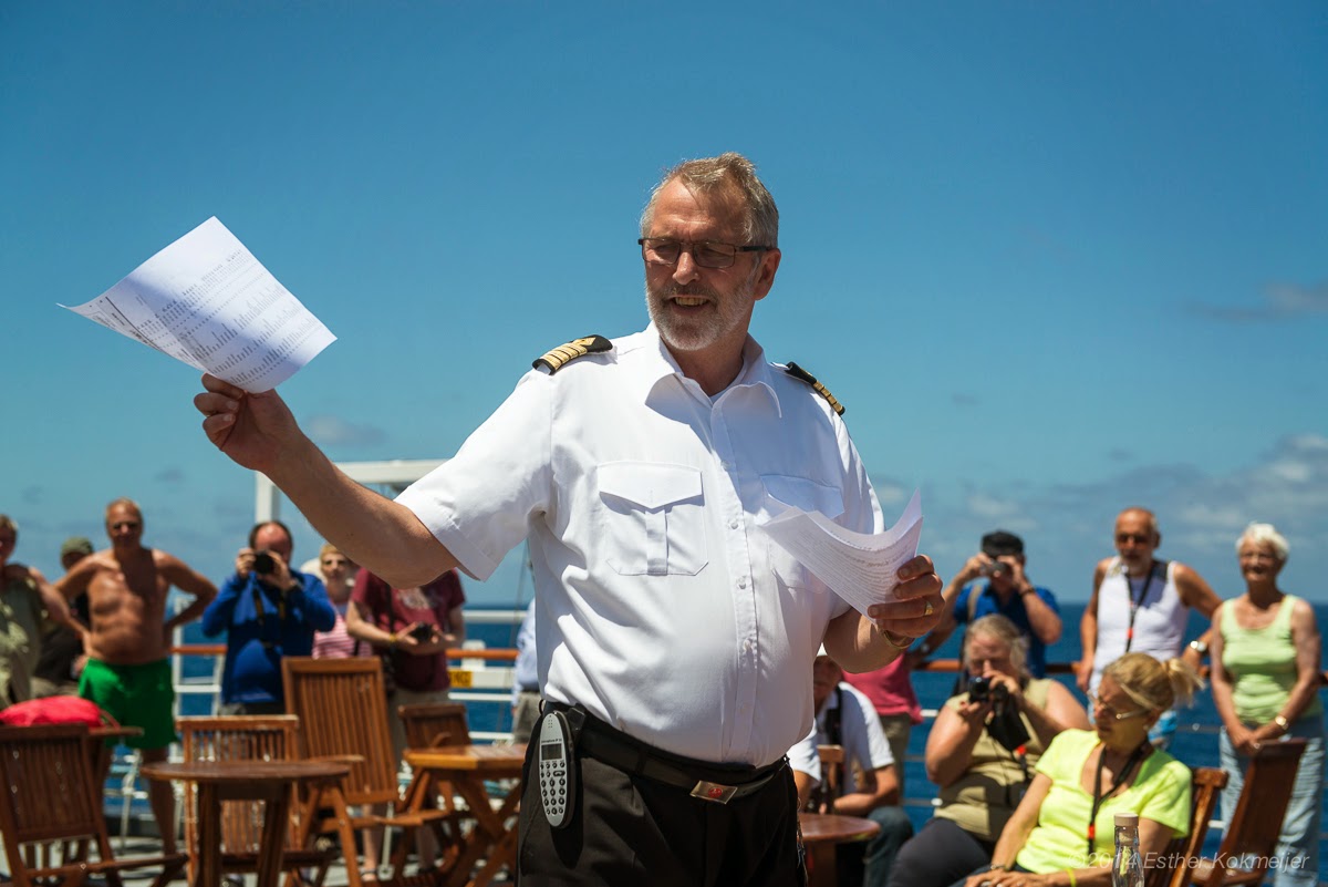


God thanks, we got the permission very fast, but there was a “but”, like there is so often a “but” in our life: the permission came in compliance with a condition of a baptism of all those passengers and crew, they have not been baptized before.


So, look at the pictures again and you, wherever you are on this wonderful planet, you can see that our Captain’s plan came true; we crossed the Equator at 21:32h and baptized all passengers and crew that did not belong to Neptune’s kingdom at that time next morning.   


Tuesday, 21 October 2014

Boring Sea days? – NOT AT ALL!!!!!!!!!!!!!!!!!!!!


Our sea days on board MS FRAM are fully packed with lots of different kind of activities. We cannot describe them all – Look at the pictures, they say more than words.

Flying Fish
Flying Fish
Sea weed
Sea weed
Drill with our rescue boat
Drill
Lecture
Bird watching

St. Peter and St. Paul Rocks: The unique possibility to see sea floor mantle rocks above sea level

Who is sailing next to the mantle rocks?
Getting the best position to photograph dolphin
Spinner dolphins, Photo:  Martin Overbuschmann
And more Spinner dolphins, Photo Martin Overbuschmann
Exercise with our Captain Arild
Follow the Master
Supporters are important
Fruit- and vegetable carving
Ice carving
Concentration: Our chess competition
Dart competition
Table tennis competition

Saturday, 18 October 2014

Cape Verde – Volcanic Islands in the East Atlantic

We reached the Cape Verde Islands around lunchtime on the 17th of October. Palm trees greeted us again as we expected it after we left Las Palmas two days ago. The sun was burning and the thermometer showed temperatures around 30°C in the shade and in the water as well, but we are on an explorer ship and we were just ready to explore the city of Mindelo - one of the largest cities on the Cape Verde - laying on São Vicente.


The Cape Verde Islands are a volcanic Archipelago in the NE Atlantic, app. 570 km west of Senegal. Ten larger, nine of them inhabited, and several small islands are divided in the islands over and under the wind (NE Trade). The archipelago was formed over a hot spot, a huge magma chamber and the oldest islands are Sal, Boa Vista and Maio in the east. São Vicente belongs to the younger islands with a nice mountain landscape.


As Cape Verde has no original inhabitant we have no exact knowledge about the pre-colonial time. It looks like that the islands have been known as “Gorgaden” by the very early navigators and that the Arabs sailed for salt to Sal, one of the easterly islands.


The first documented circumnavigation of the islands has been done by the Portuguese navigator Antonio Fernandes. 1460 the Genovese Antonio da Noli discovered the islands and named them Ilhas do Cabo Verde. Cape Verde became a Portuguese colony as da Noli discovered the islands in the name of the Portuguese “Henry the Navigator” (Infante Dom Henrique de Avis, Duke of Viseu). Da Noli founded the first European tropical city, Cidade Velha (Cidade de Ribeira Grande) on Santiago. During 1500 and 1620 Cape Verde became a very important “transfer site” for slaves. That’s the reason why we could see so many dark skinned people living on the islands. The islands got later on an importance for the English salt trade and for its coal harbors but pestilences, aridity and hunger crises set an end to the economic importance of the islands. After a longer independence fight against Portugal the islands got their Autonomy at the 5th of July 1975.

Mindelo, the capital of São Vicente has been always very important for its natural deep water harbor. In historical time it was famous for its coal bunker, today the harbor is more well-known for the tourism as also bigger cruise liners can be safely docked at a modern pier.


We docked at this pier also and started our city excursion as soon as the ship had been cleared in. Even it was very hot we enjoyed our walk through the town. Full of new and very deep impressions we came back on board. Look at the pictures and you can take at least a little bit part of our experiences.


As we stayed overnight in the harbor we had the evening and the next morning to learn the city by ourselves. There was even time for a beach visit before we left Cape Verde for our next destination of Salvador da Bahia in Brazil.