Showing posts with label John Chardine. Show all posts

Thursday, 26 November 2015

Iceberg graveyard and Pleneau Island

We had a very interesting day today. The morning was a little different in that instead of a landing we planned a small-boat cruise around the icebergs in Pleneau Bay. The bay is quite shallow and the bergs that float into it become grounded- hence "iceberg graveyard". But of course we cannot forget that to get to Pleneau Bay we had to navigate through the amazing Lemaire Channel. We did this successfully as there was little ice to impede us.


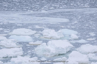
Pleneau held icebergs of every shape and size. Some were magically blue- caused by the selective absorption by water molecules in the ice, of the red, orange and yellow light, leaving the greens and blues behind. A lone Adelie Penguin was spending a nice morning on one of icebergs!


Back on the Fram we sailed down the Penola Strait to Petermann Island, under beautiful sun and clam conditions. The expedition team landed and set up shop but it soon became clear that a massive amount of pack ice sitting in the strait to the south was moving slowly towards us, blocking the landing site. 


Wisely, we aborted the landed and went to "plan B", which was back to Pleneau Bay and onto the Pleneau Island. By the time we got up there, the weather had dramatically changed to what we were used to for the cruise- wind and snow! Despite this we made a wonderful landing there- a true Antarctic experience! A very inquisitive Gentoo inspect Nick's Canon camera. Penguins clearly like Canon better than Nikon!


To top it off, our campers set up on nearby Hovgaard Island and had a wonderful night there.

Wednesday, 25 November 2015

The popular Cuverville

The light snow continues as we make our way down the Antarctic Peninsula. Today we stopped at the popular landing spot of Cuverville Island, situated in the stunning Errera Channel. Your faithful blogger first set foot on this island 20 years ago at the beginning of the second wave of Antarctic adventure tourism. Since then many have visited and met the resident Gentoo Penguins.


The colony has definitely expanded over the years as Gentoos take advantage of the warming trend on the Antarctic Peninsula. The opposite is happening to the ice-loving Adelie, which is marching south in search of a cooler climate.

Monday, 23 November 2015

We are back at Deception Island again!

Faithful blog readers will be familiar with Deception Island. It is an active volcano and a small entrance known as Neptune's Bellows allows ships to sail into the volcano's caldera. Today it was blowing a gale when we arrived so we heaved-to outside the entrance and waited for the winds to calm. They did so and we sailed in! Once inside the winds still blew fiercely but from a direction that allowed a landing in Whaler's Bay.

Behind our landing and near the freshwater pond were several Brown Skuas. Seabirds such as skuas often bathe in freshwater to wash the salt out of their feathers. They seemed quite at home in the winds and snow.
The snow was flying around the oil tanks at the whaling station, providing a very Antarctic look
After our landing, we cruised around the Deception Island caldera. Deeper inside, we found sea-ice still stuck fast to the land from last winter. Our Captain decided to break some of it!

Saturday, 21 November 2015

Names can be deceiving!

So after a great surprise yesterday when we cruised in the vicinity of Point Lookout on Elephant Island, today, we visited Penguin Island off the south coast of King George Island in the South Shetlands. This was our first proper landing of the cruise and what a landing it was! But first, the name Penguin Island is somewhat misleading in that, yes there are penguins breeding- Chinstraps- but not so many, and there is SO much more to see there. The island is an Antarctic oasis with meadows covered in Antarctic Hairgrass and several species of birds breeding, including the skittish Southern Giant Petrel.

When we arrived at the landing site we were confronted with a wall of ice and snow from the previous winter. We did not let that stop us and the stair-masters Stian and Johannes set to building what has to be the VERY BEST set of ice-stairs ever made in Antarctica.


Where there are penguins, there are skuas! These are Brown Skuas, which mainly nest on sub-Antarctic islands but can be found on the northern tip of the Antarctic Peninsula as well. Here a pair is shown eating a fish one of them has just freshly caught just off the beach.


Through the whole landing this magnificent arched iceberg showed off in front of us!


And to add to to the drama, these amazing lenticular cloud formations were a backdrop to our ship, the MV Fram.


Thursday, 19 November 2015

USH

USH is how we refer to Ushuaia and Ushuaia is where Fram is today. This most southerly city in the world conjures up so many impressions, especially for your faithful blogger who has been coming here for 20 years. Ushuaia has has developed so much in those 20 years, most thanks to the Antarctic cruise industry which uses the port as a base of operations for the peninsula. Argentina also encourages nationals to move to the city with tax breaks and subsidies on commodities like fuel oil.

USH lies on the famous and beautiful Beagle Channel, named after HMS Beagle charted the area in the early 1800s. The channel is spectacular with snow-capped and tree-clad mountains on both the Chilean and Argentinean sides.

As we sailed out of USH east down the Beagle Channel, the light played with the surrounding landscape, providing a fitting farewell to Fram.


Sunday, 15 November 2015

South!

It is not often this early in the Antarctic summer season that you are able to navigate through the Lemaire Channel, then farther south to Petermann Island. The winter sea ice is usually heavy and the Lemaire is often blocked with smaller icebergs. Despite the dire warnings of heavy sea ice this Antarctic season, we found almost none and we could easily reach Petermann Island in the morning.
Picture by Johannes C. Apon
In a fresh breeze we landed on a snow bank to the right of our normal landing in Port Circumcision, and then explored the amazing island. At first the light was grey and flat but then the sun came out and made for wonderful views of the mainland on the other side of the Penola Strait.


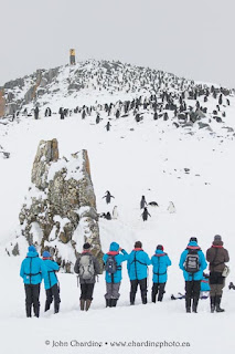
Mount Scott stood proudly as a backdrop to Petermann. In the foreground are penguins, but therein lies a story. Twenty years ago the common species on Petermann was the Adelie but over the intervening period, they have declined and Gentoos have increased. It appears that there is little direct competition between the two, rather, the trends are related to differing reactions to climate change. The Antarctic Peninsula has warmed more than any place on Earth over the last 50 years and this has meant less sea ice. Since krill rely on sea ice as a grazing habitat, they have declined on the peninsula. Adelies are krill specialists and have suffered with lower breeding success and insufficient recruitment to replace natural mortality in the adults. Thus the colony at Petermann has declined. Gentoos on the other hand can tolerate warmer conditions and are more flexible in the feeding habits. Their breeding success has been good and recruitment high. Their populations have been increasing on the peninsula and their distribution is moving south. Petermann is the most southerly breeding station for Gentoos in Antarctica so far but they are marching south!

A beautiful penguin feather lay on the snow at Petermann. The small things are interesting too!
Breeding with the penguins along the cliff edge were Blue-eyed Shags.
Part of the now small Adelie Penguin colony at Petermann
Gentoos doing what they do best at this time of year!
Amazing skies at the end of our landing!
A constant feature of our landing was the Gentoo Penguins returning from a feeding trip in large flocks. Then walking up onto the island and to their breeding locations. Why are the white penguins walking towards us, and the black ones walking away?!!!!


So this was our last landing in Antarctica and we are now headed across the Drake Passage to Ushuaia and then home. But we still have a couple of days to see more wildlife before we go ashore!

Friday, 13 November 2015

little island in Antarctica

So after three days in the Scotia Sea, we arrived at our final goal- Antarctica! To be specific, at about 11:00am today we sighted King George Island at the northeast corner of the South Shetlands Archipelago. After two quite rough days at sea with Beaufort 8-9 winds and seas, it was very comforting to sight land! And, although indeed we were seeing land, most of it was covered in a thick layer of glacial ice and snow.

After several hours of cruising down the southeast coast of the South Shetland Islands we turned to the starboard and entered the McFarlane Strait between Greenwich and Livingston Islands. From there we sailed to our first Antarctic landing of Half Moon Island. The conditions were ideal for the landing with calm conditions and nice light. There was a small swell at the beach, and together with the chucks of ice, these made the landing a bit more challenging than normal.


Excitement filled the air as we came ashore and started to really experience Antarctica. Almost the whole island was covered in a thick layer of ice and snow from the last winter. As we approached the black dots on the ice above the landing site we realized that they were Chinstrap Penguins. The breeding season was just getting going and much courtship was going on. Snowy Sheathbills ran around the colony eating anything they could find.


Our snowshoers were able to travel over the covering of snow with ease, and really see a lot of the island and its surroundings. And our kayakers explored the whole offshore area. Our first landing was a huge success and put smiles on everyone's faces and it was a great start to the last segment of our expedition cruise.


Tuesday, 10 November 2015

Grytviken

After a great but cloudy day yesterday, we awoke to bright sunshine as we arrived to Maiviken (May Cove). There we dropped off our intrepid hikers who were to make their way up and over from Maiviken to Grytviken. The hike was spectacular with sun and little wind and an added bonus was the sighting of the endemic South Georgia Pipit at the beginning of the hike.

Image by Verena Meraldi
After the massive rat eradication program that just finished on South Georgia, the pipits are coming back. Rats eat the eggs and chicks of the pipits and many of the smaller seabirds breeding on the island. Although the eradication program has been completed, you can still contribute to the funding shortfall by going to the South Georgia Heritage Trust website: www.sght.org.

Yesterday we visited the whaling station at Strømness, which was off-limits to us because of asbestos risk and because the buildings are very unstable. Today in Gryviken we were able to actually walk through the remains of the Norwegian whaling station there. A few years ago the South Georgia government and the South Georgia Heritage Trust cleaned up the station of hazards with the result that access is now possible. By the way, a 'gryt' is a try pot (from Norwegian): a cauldron used to boil the seal blubber in the early days of Antarctic exploitation. To 'try-out' is render the oil our of the blubber. 'Vik' is a bay in Norwegian. 

Here you can see various tanks and generators in the whaling station and in the distance, the old church dating from 1913.


The chains used to pull the dead whales up the flensing plan lie in a pile.


A Wandering Albatross mount peers out the window of the Carr Maritime Gallery towards the Fram anchored offshore. The gallery is part of the museum at Gryviken.


An Antarctic Tern hunting for food need our landing site.


Some beautiful lenticular clouds developed of the mountains near Gryviken as we left.

And like our Falklands tour, South Georgia has just whizzed by- time has a different meaning in these places. Now we will spend a couple of days sailing in the Scotia Sea south and west to the Antarctic Peninsula.